#Drones for good - How are drones helping?
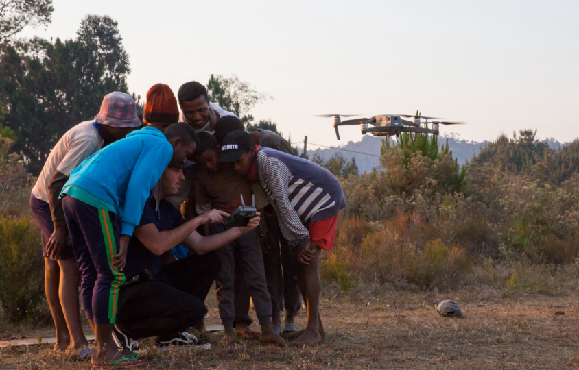
#Drones For Good
Drone technology is continually making the world a better place.
Not for profit organisations, Humanitarian groups and non-governmental organisations are using drones to help a wide range of people, animals and environments. Scientists and academics are finding new ways to study and improve our world with drones. Rescue organisations have saved hundreds of people from danger using drones.
#dronesforgood
Rescue
There have been many cases of drones being used to identify and find missing people. The drones can be equipped with optical or thermal imaging cameras, allowing easy identification of people.
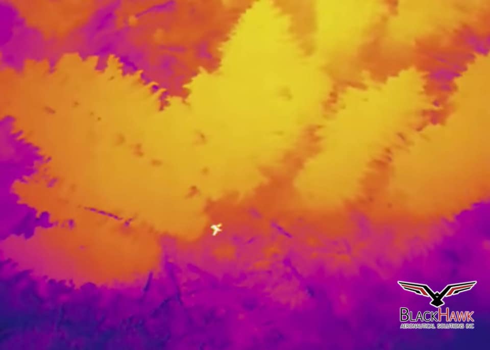
There was a recent case in America where an individual was missing for almost 24 hours. There were over 25 people searching for the person, including trucks and quads. During the search person, someone referred a drone pilot who promptly visited the site with an Inspire 1 and an XT camera. With on-ground consultation, the drone pilot was able to eliminate areas that have already been searched and built a flight path to visit hard to reach areas.
After 4 passes, an object came into view that was not your typical rabbit or deer, but it was the body of a person. The GPS co-ordinates of the drone was relayed to the on ground team and wihin minutes the person was rescued out of the thick woods.
The total time to discovery from take-off was 6 minutes.
Natural Disasters
Bush fires in Australia, Wildfires in the US, Rising sea waters and plastic in the oceans are unfortunately re-occurring headlines in the news. Researchers have now found a new, safer way to gather data and analyse their data through drones.
For example, a research team in the US are using drones to observe how smoke and fire behave in large files. This data can be relayed to fire authorities and land managers. Typically during these fire situations, helicopters are not permitted to fly too close to the smoke, so using unmanned drones has become to go to solution. With the large collection of photos and videos, the researches were able to obtain insights they could not get before.
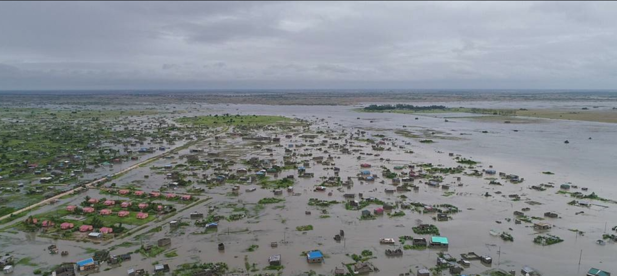
Furthermore, these drones can be used to more safely, quickly and reliably get medical supplies to help those are in need after a natural disaster. In Mozambique, drones were deployed during and after cyclone Desmond to track rising flood waters and chart better evacuation plans for people trying to escape them. Using the live images taken at a close range, rescuers were able to respond much faster than in previous years.
After a natural disaster, the view from above is absolutely key for humanitarian organisations, which is where satellite imagery had a pivotal roll. However, the catch for satellite imagery is they have limitations regarding costs, data sharing restrictions, cloud cover and the time needed to acquire the images.
This is where drones shine with their ability to capture aerial imagery at a much higher resolution at a significantly faster rate. Furthermore, UAV's are not limited to one or a few owners. Drones that are owned by the public can be used together to create large scale maps in no time.
Conservation
Tropical biodiversity is unfortunately in a decline due to large scale deforestation, natural disasters and poaching. To prevent these from happening, data and surveys need to be completed. The usual way is through ground surveys, however they take a fair amount of time to complete and are limited to certain areas. Furthermore, ground surveys are expensive and time consuming.
Drones have allowed the easy data gathering for conservationists where they can set pre-determined flights and count what is necessary.
Such as in Southeast Asia where a team has used drones to count the orangutans nests from the air, which greatly reduces needed resources.